


Aaronia AG
Aaronia GPS Logger with 6 Sensors
Aaronia GPS Logger with 6 Sensors
SKU: 503/035
Couldn't load pickup availability


Key Features
Overview
Downloads
Why Engineers Choose The Aaronia GPS Logger with 6 Sensors
RF Site Survey Documentation
Antenna Pattern Verification
Mobile Asset Tracking
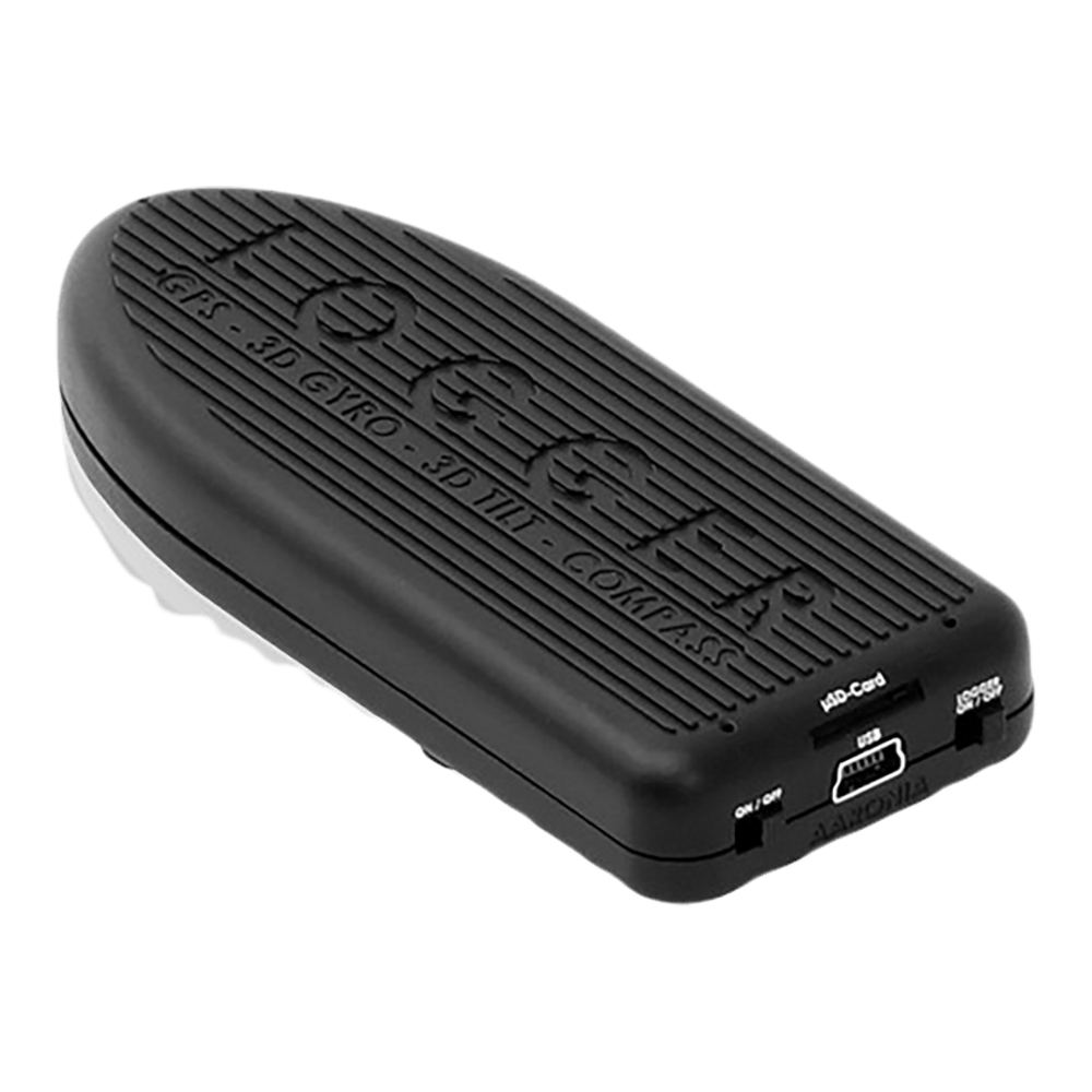
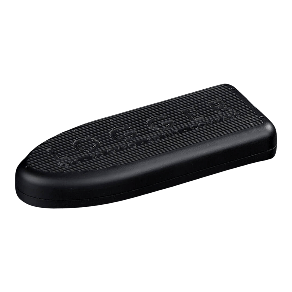
Multi-Sensor GPS Data Logging System
The Aaronia GPS Logger (503/035) represents the world's first standalone data logger integrating six cutting-edge sensors within an ultra-compact 88-gram package. This professional-grade instrument was specifically developed for RF measurement applications where precise position and orientation documentation is critical.Integrated Sensor Suite
| Sensor Type | Specification | Resolution/Accuracy |
|---|---|---|
| GPS Receiver | 66 Channel, -165 dBm sensitivity | 1.8m (CEP95) |
| Digital Compass | 3D/Triaxial, ±8 Oe range | 1-2 degree precision |
| Accelerometer | 3D/Triaxial, ±2/4/8g ranges | 4mg resolution |
| Gyro/Tilt Sensor | 3D/Triaxial, ±2000 °/sec | 14 LSB per °/sec |
| Altimeter/Pressure | 260-1260 mbar range | 20cm height resolution |
| Temperature | -20°C to +45°C range | Environmental monitoring |
High-Speed Data Acquisition
The logger achieves exceptional data rates up to 35 complete sensor readings per second, capturing all parameters simultaneously with microsecond-accurate timestamps. At maximum rate, the system generates approximately 50MB/hour of uncompressed data, enabling detailed analysis of rapid position and orientation changes during mobile RF measurements.RF Measurement Integration
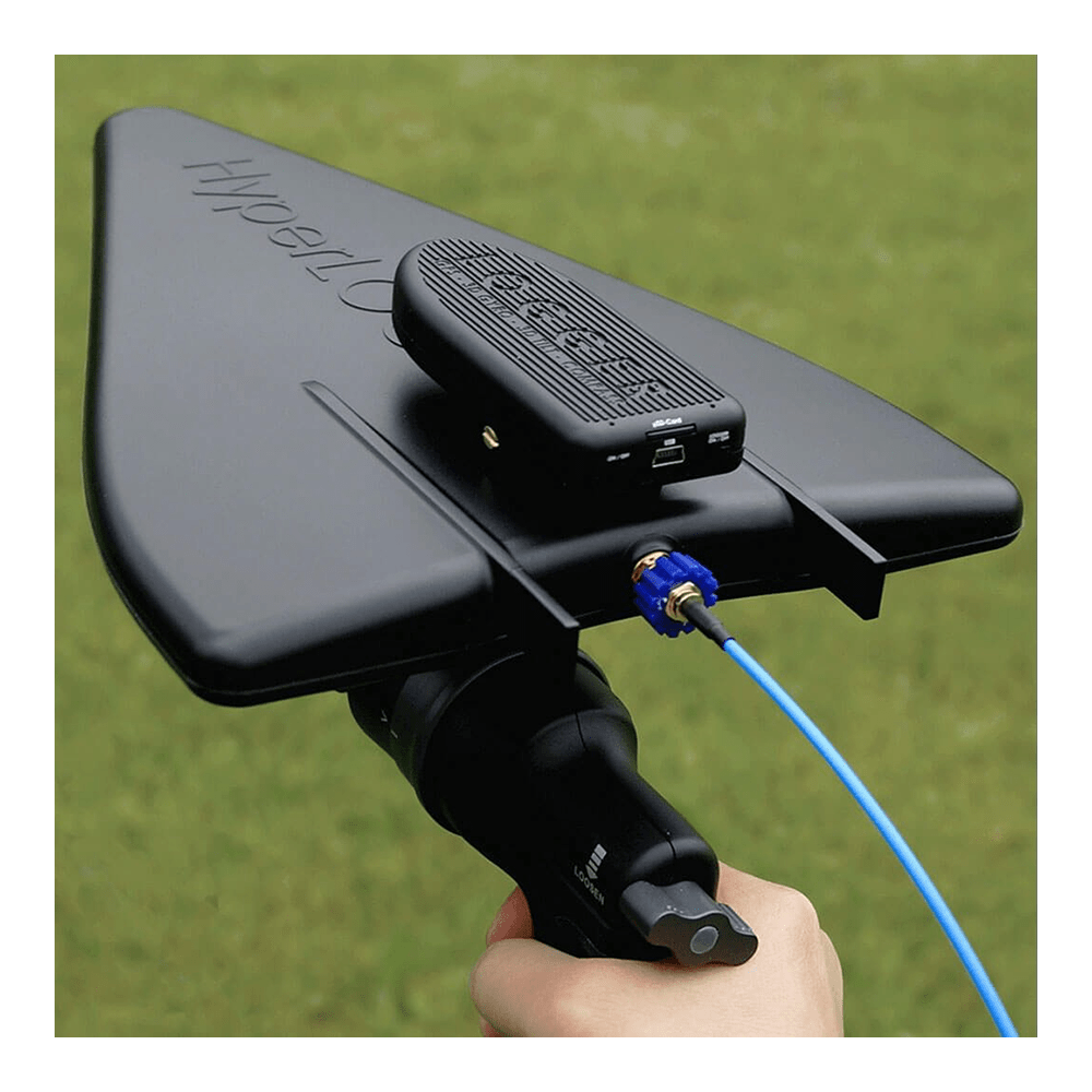
Originally designed for Aaronia's antenna systems, the GPS Logger creates comprehensive "RF heat maps" by correlating signal measurements with precise position and orientation data. The tilt sensor and digital compass enable accurate documentation of antenna inclination and azimuth during field strength measurements.Compatible Antenna Systems
- HyperLOG X Series (700MHz-35GHz)
- HyperLOG EMI Series (380MHz-18GHz)
- Magnotracker Direction Finding Antennas
- Universal mounting via included adapter
Power Management & Storage
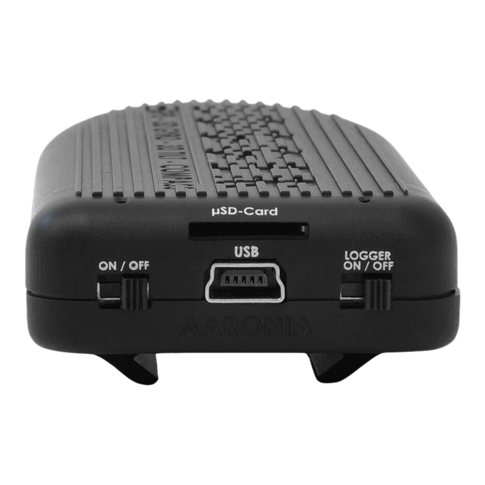
The internal 800mAh LiPo battery provides up to 7 hours continuous operation at full logging rate. USB connectivity enables unlimited recording time whilst simultaneously charging the battery. The removable microSD card (up to 2GB) offers flexible storage options:Operating Modes
- Standalone Logging: Independent operation with microSD card storage
- USB Streaming: Real-time data transmission to PC/Linux/Mac
- File Transfer: Download stored data via USB connection
Software & Data Export
Comprehensive PC software supports Windows, Linux, and Mac OS systems. Data export formats include: KML (Google Earth) NMEA (Standard GPS) GPX (GPS Exchange) CSV (Spreadsheet analysis) Binary (Native format) Wiring Quick-Start
Pin Configuration (Internal Use)
USB Connector: Pin 1: +5V Power Pin 2: Data- Pin 3: Data+ Pin 4: Ground microSD Slot: Standard microSD/SDHC format Maximum 2GB capacity FAT16/FAT32 compatible Physical Specifications
| Parameter | Value | Notes |
|---|---|---|
| Dimensions | 102 x 42 x 21mm | Compact handheld size |
| Weight | 88g with battery | Lightweight for mobile use |
| Battery Life | 7 hours maximum rate | Rechargeable LiPo |
| Shock Tolerance | 10,000g | Ruggedised design |
| Mounting | Standard 1/4" tripod | Universal compatibility |
Professional Applications
Beyond RF measurements, the GPS Logger serves multiple engineering disciplines:- EMC Compliance: Document measurement positions during site surveys
- Antenna Testing: Record pattern measurements with precise orientation
- Vehicle Dynamics: Track mobile platform motion and position
- Asset Monitoring: Long-term position and motion logging
- Research Applications: High-resolution spatial data collection
| General Information | |
|---|---|
Part Number (SKU) |
503/035
|
Manufacturer |
|
| Physical and Mechanical | |
Weight |
1.0 kg
|
| Other | |
Warranty |
|
HS Code Customs Tariff code
|
|
EAN |
5055383603947
|
Frequently Asked Questions
Have a Question?
-
What makes this logger suitable for RF measurements?
The combination of precise positioning and orientation tracking enables creation of "RF heat maps" correlating signal strength with exact antenna position and pointing direction. This capability is essential for EMC site surveys and interference location.
-
Can data be exported to mapping applications?
Yes, the included software exports data to Google Earth KML format, Google Maps, and standard GPS formats (NMEA, GPX). Real-time USB streaming enables live position tracking on PC, Linux, or Mac systems.
-
What operating temperature range does the logger support?
Operating temperature range is -20°C to +45°C with humidity tolerance below 90% RH. The compact design (102 x 42 x 21mm) withstands shock up to 10,000g.
-
How accurate is the digital compass measurement?
The 3D digital compass delivers 1-2 degree heading accuracy across a magnetic field range of ±8 Oe. Compass calibration follows standard figure-of-eight procedure similar to smartphone compass setup.
-
What storage capacity does the device offer?
Internal microSD card storage supports up to 2GB capacity, providing approximately 2 days continuous recording at maximum data rate. Lower data rates extend recording time to weeks or months.
-
Which Aaronia antennas are compatible with direct mounting?
The logger mounts directly to HyperLOG X, HyperLOG EMI, and Magnotracker antenna series using included mounting hardware. Universal mounting adapters allow attachment to other equipment requiring only two mounting holes.
-
Can the logger operate without external power?
Yes, the internal 800mAh LiPo battery provides up to 7 hours standalone operation. Alternatively, USB power enables unlimited recording time. The device charges via the USB connection.
-
What is the positioning accuracy of the GPS system?
GPS accuracy is 1.8 metres (CEP95) with sensitivity down to -165 dBm. The system tracks position, altitude (up to 18,000m), and velocity (up to 515 m/s) with 0.1 m/s speed accuracy.
-
How fast can the GPS Logger record data?
The logger achieves up to 35 complete sensor readings per second, capturing all six sensor parameters simultaneously. This high data rate enables real-time tracking of rapidly changing positions and orientations during mobile measurements.
-
What sensors are integrated into the Aaronia GPS Logger?
The device combines six sensors: high-end GPS receiver, 3D digital compass, triaxial accelerometer, gyro/tilt sensor, barometric altimeter, and pressure sensor. This comprehensive sensor suite enables complete position and orientation tracking.